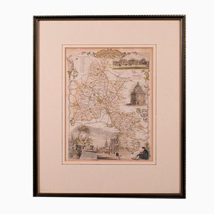
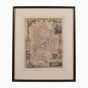
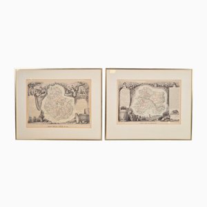
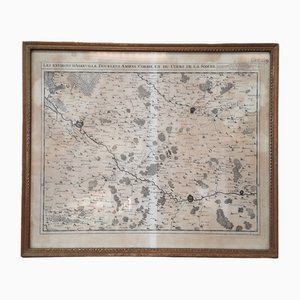
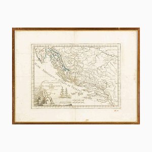
19th Century English Oxfordshire Country Map
DKK 3,664
You are now following Wall Decor. You can manage alerts in your account settings.
You have unfollowed Wall Decor.
19th Century English Oxfordshire Country Map
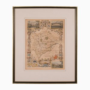
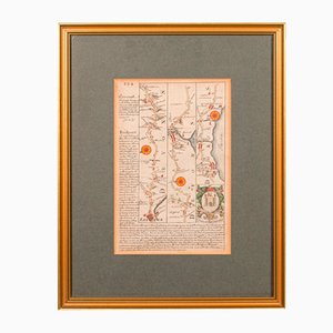
Antique English Rutlandshire County Map, 1860s
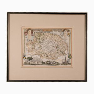
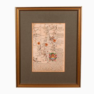
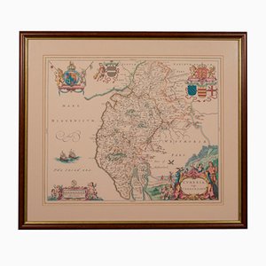
Antique English Framed County Map
Martinique, Original Early Map: Representation la plus nouvelle et exacte De L'Ile Martinique, la premiere des Iles Del' Amerique Antilles...,1741, Original Hand Colored Copperplate Engraving
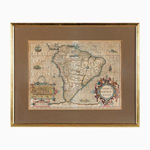
America Meridionalis, Early Map of South America by Gerard Mercator and Jodocus Hondius, 1610, Original Hand Colored Copperplate Engraving
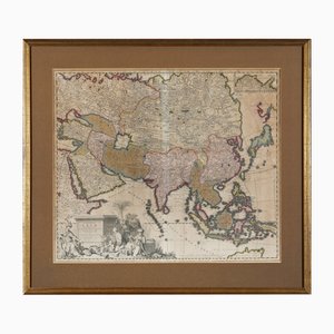
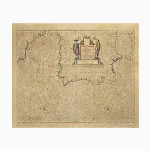
Early Map of Asia: Exactissima Asiae Delineatio in Praecipuas Regiones Original Hand Colored Copperplate Engraving by Carel Allard, 1694
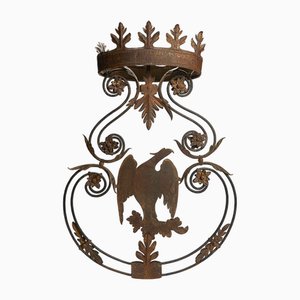
Antique Wrought Iron Sign with Eagle, 18th Century
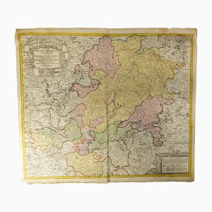
18th Century Hand Colored Engraved Map of Germany S.R.I Circulus Rhenanus
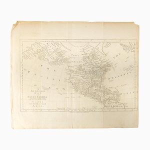
18th Century Map of North America, United States, and Asia by Bowen Thomas and Charles Cooke
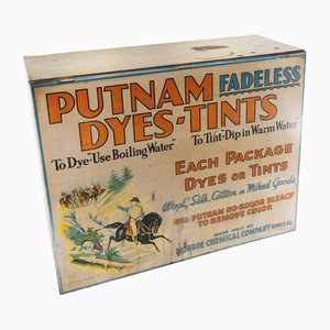
19th Century Countertop Advertising Display for Putnam Dyes-Tints
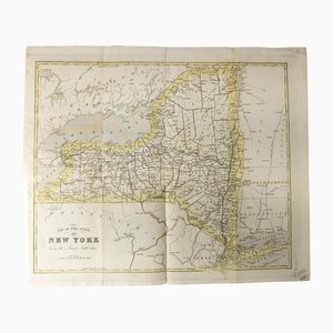
Antique Hand Colored Map of New York State from 1842
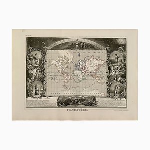
Planisphere World Map, 1849
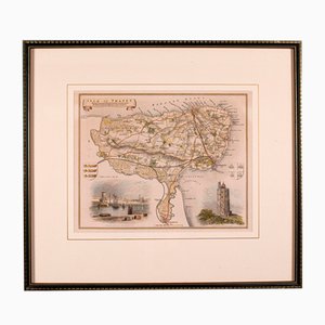
Antique English Isle of Thanet Lithography Map
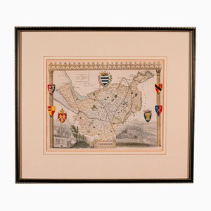
Antique Lithography Map of Cheshire, England
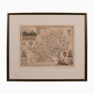
Antique Framed Lithographic Map of Hertfordshire, England
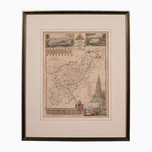
Antique Framed Lithographic Map of Northamptonshire, England, 1860
Antique Framed Lithographic Map of Bedfordshire, England
Antique Geographical Maps of the French-German War, Set of 4

Antique English Chart of Devon
Antique English Coaching Road Map
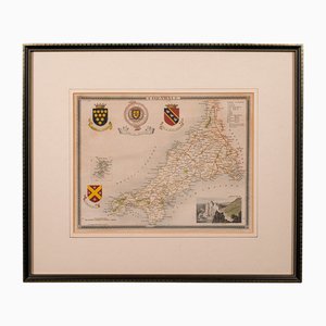
Antique English Lithography Map of Cornwall, 1850s
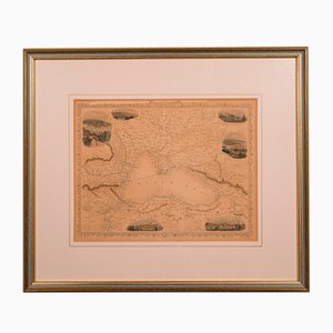
Antique English Lithography Map of Black Sea
Antique English Lithography Map
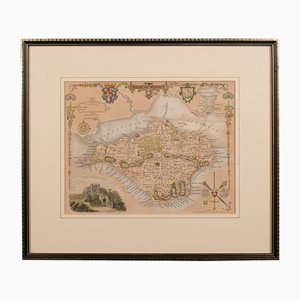
Antique English Lithography Map of Isle of Wight
French N°2 Cadastral Plan, 1933
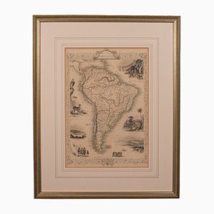
Antique English Lithography Map of South America
Plan d'Etupes N°3 Chart, 1833
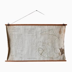
French Plan of 1788, 1825
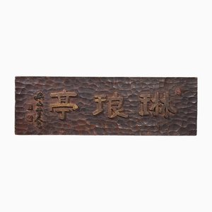
Japanese Wooden Kanban Restaurant Sign
Antique Levasseur La Marne & Cote d'Or Wine Maps, 1852, Set of 2
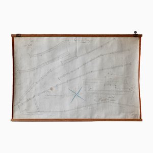
Old Map of Etupes, 1833
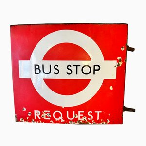
Early Enamel London Transport Bus Stop Sign with Provenance, 1940s
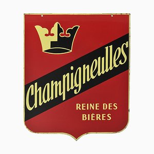
Double-Sided Enamel Sign from Champigneulles
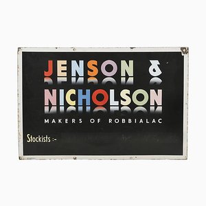
Enameled Sign from Jenson & Nicholson
North of France Map, 1710s
Johannes Janssonius, Map of Zeilan, Etching, 1650s
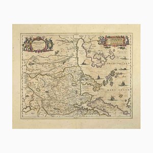
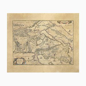
Johannes Janssonius, Map of Macedonia, Etching, 1650s
Johannes Janssonius, Thessalia Map, Etching, 1650s
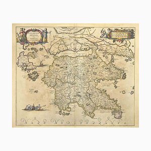
Johannes Janssonius, Peloponnesvs (Greece), Etching, 1650s
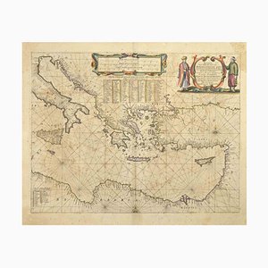
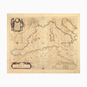
Johannes Janssonius, Maris Mediterranei, Etching, 1650s
Johannes Janssonius, Map of Dalmatia, Etching, 1650s
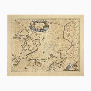
Johannes Janssonius, Map of the Poles, Etching, 1650s
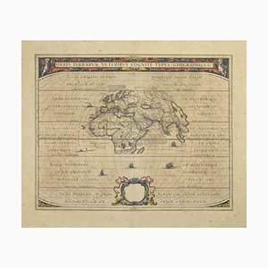
Johannes Janssonius, Orbis Terrarum, Etching, 1650s
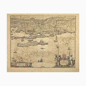
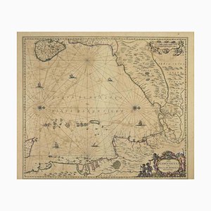
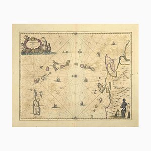
Johannes Janssonius, Gulf of Bengal, Etching, 1650s
Enamelled Goncourt Hôpital Saint-Louis Sign

Enameled Advertising Sign from La Slavia
Johannes Janssonius, Antique Map of Gallia, Etching, 1650s
Johannes Janssonius, Oceanus, Etching, 1650s
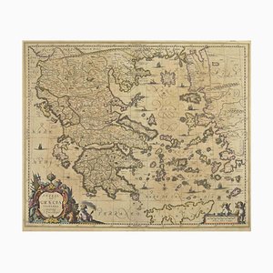
Johannes Janssonius, Antique Map of Greece, Etching, 1650s
Johannes Janssonius, Attica, Etching, 1650s
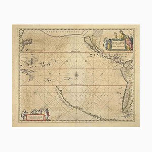
Johannes Janssonius, Antique Map of Mare Pacificum, Etching, 1650s
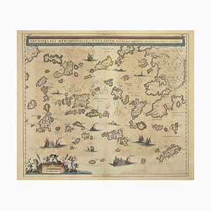
Johannes Janssonius, Antique Map of Archipela Meridionalis, Etching, 1650s
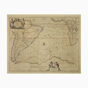
Johannes Janssonius, Antique Map of Mar di Athiopia, Etching, 1650s
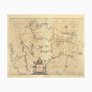
Johannes Janssonius, Freti Canalis, Etching, 1650s
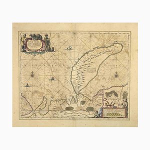
Johannes Janssonius, Nova Zemla, Etching, 1650s
Johannes Janssonius, Oceani Borealis, Etching, 1660s
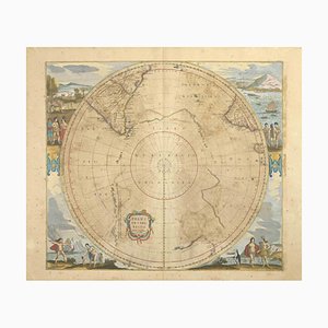
Johannes Janssonius, Polus Antarcticus, Etching, 1650s
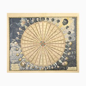
Johannes Janssonius, Anemogra Phica, Etching, 1650s
Johannes Janssonius, Barbarga, Etching, 1650s
Johannes Janssonius, S.Juan de Puerto Rico, Etching, 1650s
Johannes Janssonius, Mare Mediterra, Neum (Map of Malta), Etching, 1650s
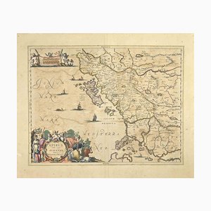
Johannes Janssonius, Epirus Albania, Etching, 1650s
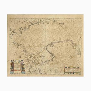
Johannes Janssonius, Mare Atlanticum, Etching, 1650s
Johannes Janssonius, Amstelredam, Etching, 1650s
Johannes Janssonius, Amstelredam, Etching, 1650s
Johannes Janssonius, Archipelagus Septentrionalis, Etching, 1650s
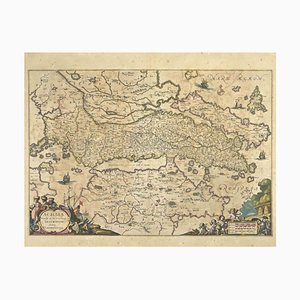
Johannes Janssonius, Achaiae Noua, Etching, 1650s
Antique Naval Map of Australia, 1888

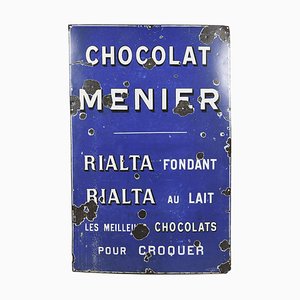
Menier Chocolate Enameled Sheet Metal Plate
Map of Scotland Etching by Johannes Blaeu, 1650s
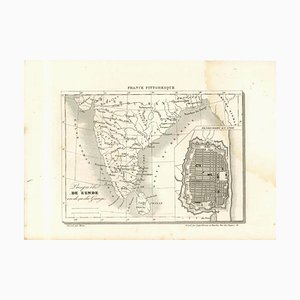
Original Lithographic Map of India, 19th Century
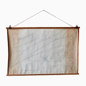
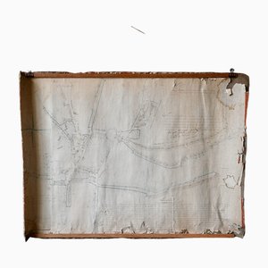
Wall Decoration Map, 1833
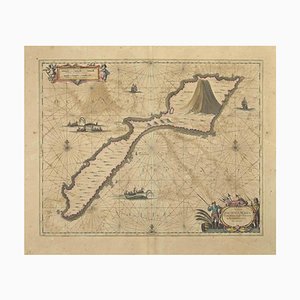
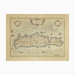
Map of Crete Etching by Johannes Blaeu, 1650s
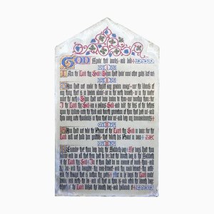
Painted Scripture of the Commandments on Slate Church Wall Panel
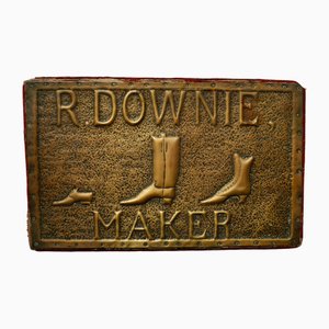
Victorian Shoe Makers Shop Sign, 1840s
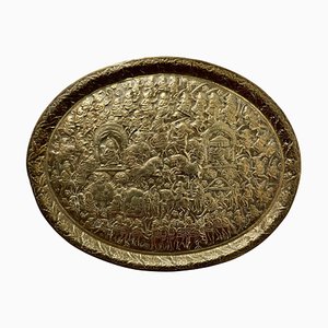
Large Oval Asian Brass Wall Hanging Marriage Charger, 1850s
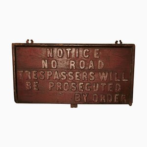
19th Century Rustic English Private Land Owners Trespassers Sign, 1880s
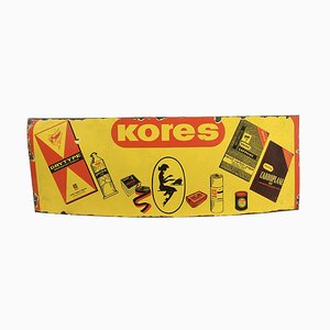
Kores Enamelled Advertising Plate
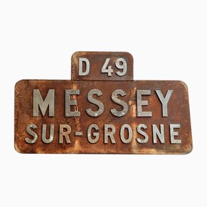
Vintage French Place Name Sign Messey-Sur-Grosne
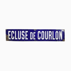
Large Enameled Ecluse de Courlon Sign
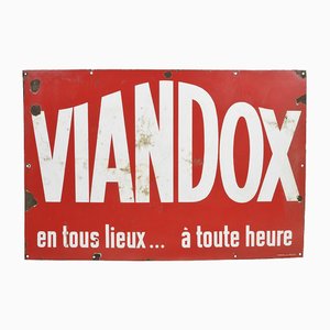
Vintage Viandox Enameled Plate
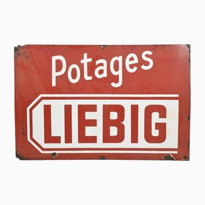
Vintage Liebig Soup Enameled Plate
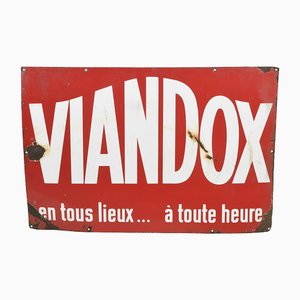
Vintage Viandox Enameled Plate
Vintage Vittel Enameled Plate

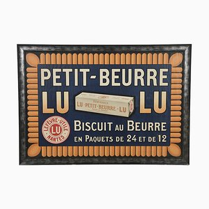
Vintage Framed Petit-Beurre LU Advertisement Sign
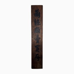
Japanese Meiji Era Wooden Cocoon Silk Trading Center Sign
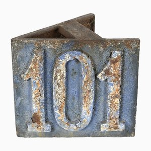
Cast Iron Street Number 101
Giovanni Mignani, Map of Dalmatia & Adjacent Islands, Etching, 1792, Framed
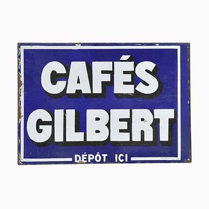
Gilbert Double-Sided Enameled Plaque
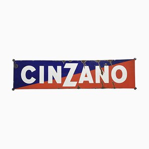
Cinzano Advertising Enamel Plaque
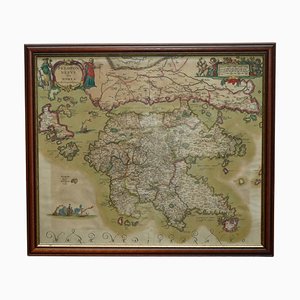
Cartographic Map of the Russian Empire by Frederick De Wit, 17th Century

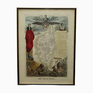
French Hand Watercolour Map of Dept des la Corse, 1856
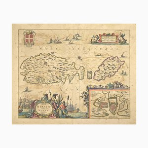
Peloponnesus Sive Morea I Laurenbergio Greece Watercolour Map by Jan Jansson, 1660
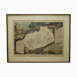
French Hand Watercolour Map of Dept des Hautes Pyrenees, 1856

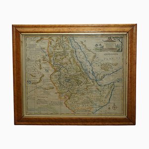
Watercolour Map of East Africa by Eman Bowen, London, 1744
French Hand Watercolour Map of Dept des Hautes Pyrenees, 1856
Trending